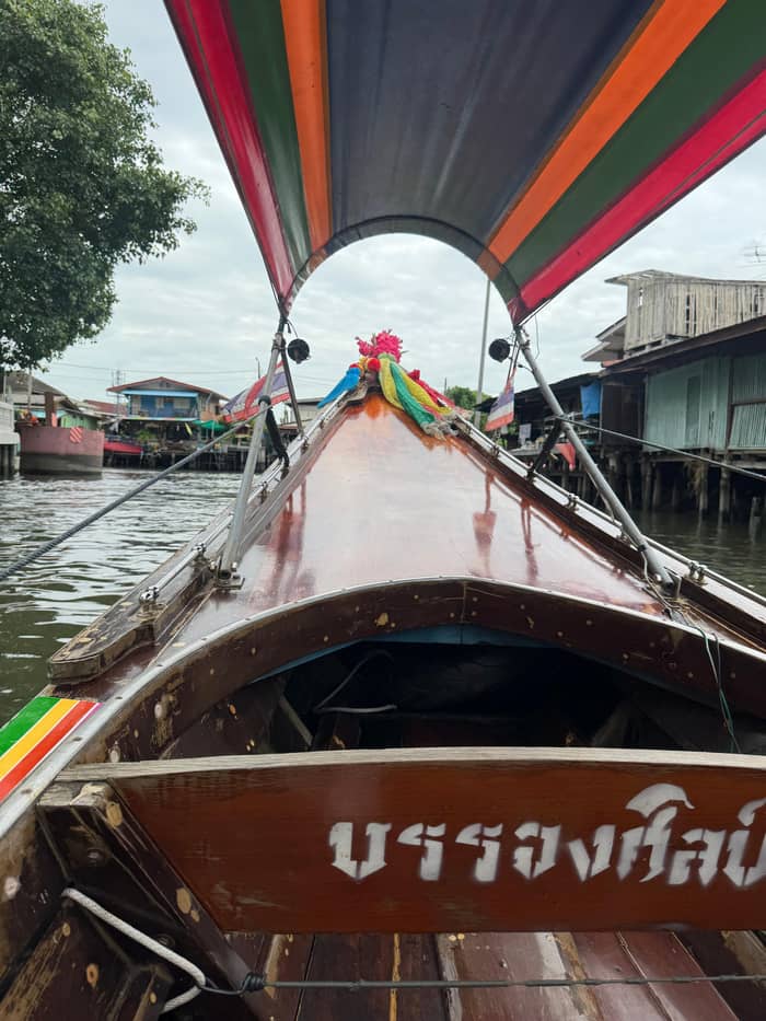
2 hours
The site's longtail trip
Short and guided
- Length2 hours
- StopArtist House
- GuideLive, English
- From$34
Map your stop
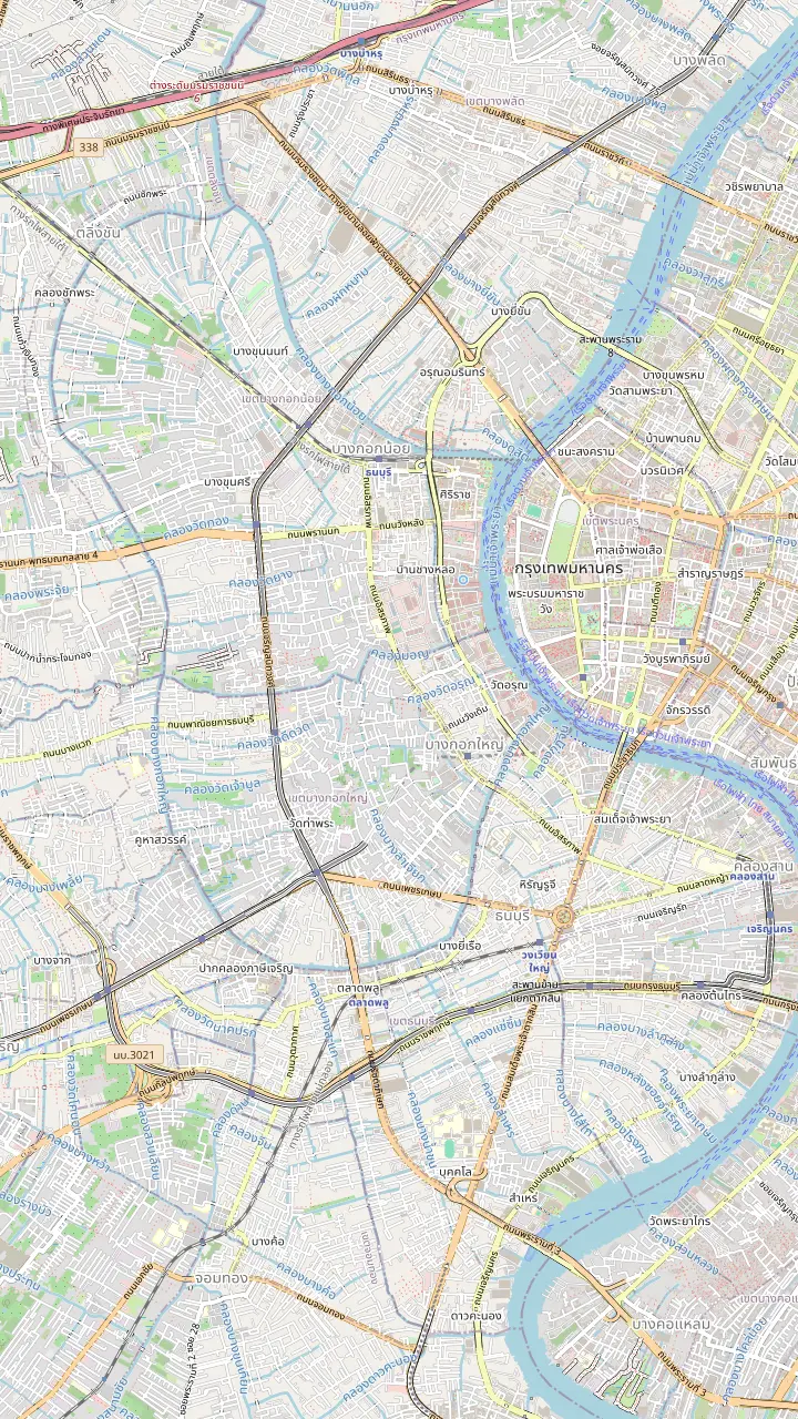
Wat Arun, the riverside temple the longtail boats pass on the Chao Phraya; TAT gives its pagoda as 66.8 metres high.
Google MapsWat Kalayanamit, one of the lit riverside landmarks on TAT's 2026 Vijit Chao Phraya route.
Google MapsThe Santa Cruz church in the Kudi Chin riverside quarter, the area TAT writes Kadeejeen and links with a Portuguese community on the Thonburi side.
Google MapsWat Paknam Phasi Charoen, named in the site's record as a photo stop passed by boat for 10 minutes.
Google MapsArtist House Bangkok on Khlong Bang Luang, the stop the site's record gives 40 minutes; the house itself lists 10 AM to 6 PM.
Google MapsThe Royal Barges National Museum, the house of the royal barges TAT mentions in its royal barge news.
Google MapsMemorial Bridge, which the Vijit Chao Phraya light route passes between Wat Arun and the southern river.
Google Maps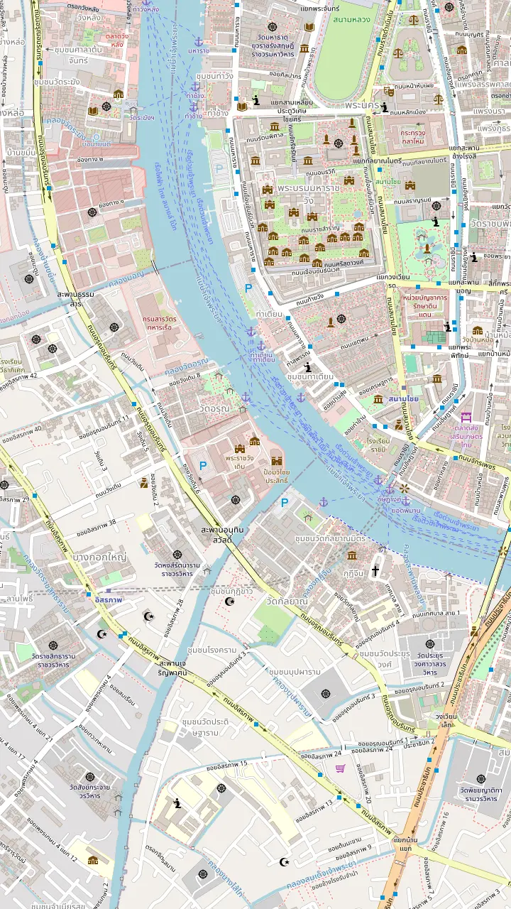
The bus stop opposite Elefin Coffee on Maha Rat Road, just south of Wat Pho, where the site's record has you meet the guide.
Google MapsWat Pho, next to the meeting stop; TAT gives its reclining Buddha as just over 43 metres long.
Google MapsTha Tian Pier, the river stop beside Wat Pho and across from Wat Arun; some canal tours start and end here.
Google MapsSanam Chai MRT station, the nearest station on the Wat Pho side of the river.
Google MapsWat Arun, the riverside temple the longtail boats pass on the Chao Phraya; TAT gives its pagoda as 66.8 metres high.
Google MapsItsaraphap MRT station on the Thonburi side, the station TAT recommends for Wat Arun.
Google Maps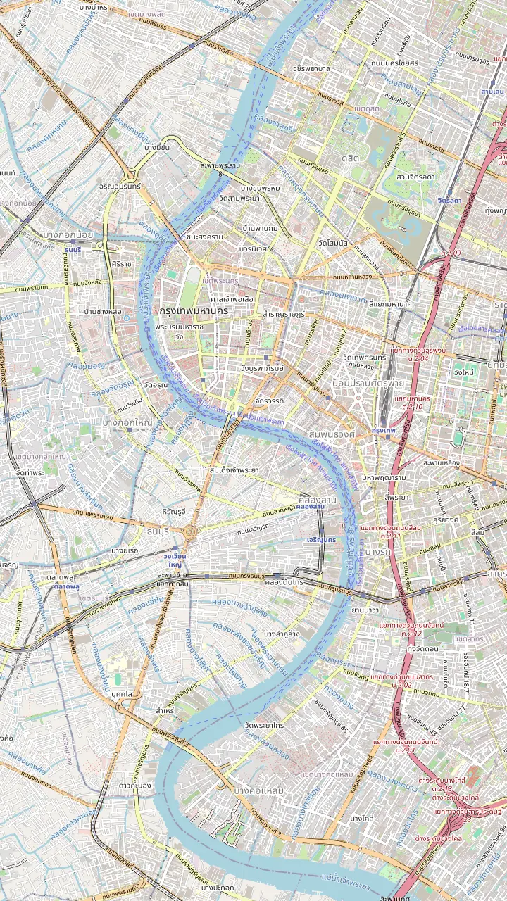
Tha Chang Pier by the Grand Palace, the meeting area of a different canal tour and a temple walking tour.
Google MapsTha Tian Pier, the river stop beside Wat Pho and across from Wat Arun; some canal tours start and end here.
Google MapsWat Arun, the riverside temple the longtail boats pass on the Chao Phraya; TAT gives its pagoda as 66.8 metres high.
Google MapsMemorial Bridge, which the Vijit Chao Phraya light route passes between Wat Arun and the southern river.
Google MapsSathorn Pier at Saphan Taksin, the BTS-linked pier of the Chao Phraya river boats.
Google MapsRiver City Bangkok, the starting point of a teak boat canal tour.
Google MapsMap data by © OpenStreetMap contributors
What the khlongs are, why the west bank of the Chao Phraya kept so many, which ones a longtail boat enters and what the canals still do for the city.
Editorial team, bangkokcanaltour.click · Updated November 16, 2026 · 9 min of reading
Basics
The Thonburi canal network is what remains of a time when Bangkok moved by water. TAT describes a city that grew around a web of canals, the khlongs, where homes floated on boats or stood on stilts over the water.4 The Thonburi side of the river is where a longtail boat still leaves the broad river and slips into that older layout, which is why a canal tour here feels like a different city from the towers on the skyline.
Thonburi is more than a bank of the river. TAT dates Thonburi's time as capital to the years 1767-1782, after which Bangkok, founded in 1782, took over on the other shore.2 Facing the old palace district across the water, Thonburi holds temples, narrow waterways and a riverside quarter where, TAT writes, a small Portuguese community settled more than 200 years ago.5 Much of it is still reached more easily by boat than by car, and that is the ground this guide covers.
A word on spelling saves confusion. Khlong, klong and canal all name the same thing in Bangkok, and listing titles use every spelling. The map at the top of the page shows the temples, the quarter and the canal-side house that a boat passes or visits, and the sections below move from the history of the water city to the canals that still work, to how you see them yourself and what to check before you go.
Named canals
| Place | What it is | Dated fact | Visitor use |
|---|---|---|---|
| Khlong Bang Luang | Canal with the Artist House | House listed as 200 years old9 | A 40 minute stop on the site's tour |
| Phadung Krung Kasem Canal | City moat-side canal | Constructed in 185110 | Free BMA electric boat daily11 |
| Klong Ong Ang | Renovated canal street | UN-Habitat award for the renovation12 | Walking street Friday to Sunday13 |
| Lat Pho Canal | Flood-relief cut at Phra Pradaeng | Deepened and widened in 200514 | A park and small museum below the bridges15 |
| Bangkok Yai | Large Thonburi canal | Named by a bike and boat listing | A 50 minute longtail ride on that listing |
| Thonburi Naval Dockyard | Royal barge base | Public viewing in 202416 | Check the Royal Thai Navy for dates |
Dates and uses follow TAT, the venue's own site and the listings; check the operator for current service.10
Older Bangkok was built for boats. TAT puts the scale plainly: close to 90 per cent of the city's people lived on its canals in the 1840s.1 TAT adds that theatres, shops and restaurants were run from boats and that people went between them on small rowboats.6 That watery way of life led to the nickname Venice of the East.7 The nickname is a cliche now, but the fact behind it is solid: for a long time the klongs were the city's streets.
Roads changed the picture, and today the canal front is the exception rather than the rule. Where a lane still ends at a landing and the houses face the water instead of a street, you are looking at a canal that kept its old job. Those are the stretches a boat is good at finding, and they are why the west bank is a better place for a canal ride than most of the modern, road-first city.
What you see from a boat is therefore partly a survival and partly a revival. The old house fronts, the stilts and the wooden landings are original in places and restored in others. Artist House Bangkok, on Khlong Bang Luang, says it has been open to visitors for more than 17 years, and its building is a wooden house about 200 years old.8,9 Look at how the walls meet the water and you can read the old street plan.
Boat time
Total length of each listing, not time afloat; every listing includes some time ashore.
From the water the klongs are narrower and slower than the river. Houses face the canal with a landing in front, and fences and plants lean over the edge. The site's record lists the stops of its tour in order: a 20 minute river boat leg, a pass-by of Wat Arun, a short photo stop where the boat passes Wat Paknam Phasi Charoen for 10 minutes, then the longest halt, 40 minutes ashore at the canal-side Artist House, and a 20 minute leg back. That is the boat trip this site sells, and the rest of this page is the setting for it.
The Artist House is the stop where the canal becomes a place you walk, and the page on the side stops describes it in full. Beyond it, the riverside quarters of the west bank have their own crafts. At a 2017 fair TAT showed Khon masks from the community of Soi Wat Suwan and paper mache piggy banks made in the community around Prayurawongsawas Woravihara Temple, both from the Khlong San and Thonburi districts.17,18 Those are the kinds of workshops that sit down the lanes from the canal.
Bring respect with you. Residents live a few steps from the water, and a polite wave or smile before a photograph goes a long way. Keep your voice down near the houses, never trail a hand or a bag in the water, and do not step onto a private landing. The Artist House posts its daytime opening hours on its own website, and its puppet shows are reserved for private groups who book ahead; do not count on a performance.19,20
Pick a boat
Tell us what you want from the klongs and the answer points to a listing or a free ride.
If I want the short guided version
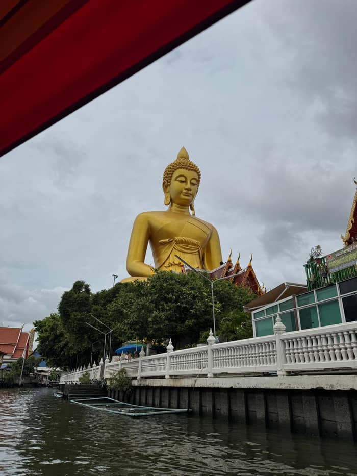
The site's longtail trip
The record gives a 2 hour trip with a stop at the Artist House.
If I want a small group
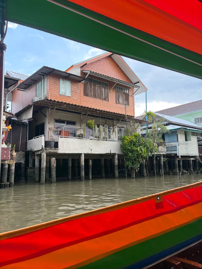
The Big Buddha view trip
The record limits it to 8 guests.
If I want to cycle as well
The bike and canal boat day
It adds a 50 minute longtail ride on Bangkok Yai after cycling.
If I want my own route
A private longtail
The record lists a customisable route for a private group.
If I want a free canal ride
The BMA electric boat
TAT says it operates daily, free of charge.11
Ways to see the klongs
2 hours
Short and guided
Up to 8
Small group, a gallery stop
3.5 hours
Pedal, then paddle by boat
Visitors ask which canals a tour uses, and the honest answer depends on the listing. The site's own record names Khlong Bang Luang for its stop and gives no other canal. Another listing, a cycling and boat outing, names Bangkok Yai for a longtail ride of 50 minutes, after cycling past temples and a food market. If you want a Bangkok Yai canal tour specifically, check the itinerary of the listing before you book, because the titles rarely name the klong.
The large waterways of Thonburi meet the river at separate mouths. Bangkok Yai runs south of Wat Arun and Bangkok Noi to the north, and the smaller side canals join them. The Royal Barges National Museum sits on the north side of the river, close to the Bangkok Noi end.16 The navy keeps the ceremonial fleet on this side too, since TAT's royal barge news for 2024 sent the public to a Thonburi dockyard to see the boats.16
Some canals are closed to ordinary traffic and some have locks. The site's record warns that guests may wait at a water lock that regulates the level of the canal, on no fixed schedule, and that boarding is without stairs. Plan your day with that wait in mind, and do not schedule a tight onward connection right after the tour. The lock is a working part of the system and not a staged attraction, which is exactly why it is worth seeing.
Plan the cost
Choose a party size and the from-prices scale with it.
≈
View≈
View≈
View≈
ViewGetYourGuide's starting prices, converted at the ECB reference rate; exact pricing appears when you book.
A morning on the klongs
Meeting
The record puts the meeting point at a bus stop facing a coffee shop on Maha Rat Road near Wat Pho.
River leg
A 20 minute boat leg across the Chao Phraya opens the trip.
Pass-bys
The boat goes past Wat Arun, then gives Wat Paknam Phasi Charoen a 10 minute photo stop.
The stop
Most of the time ashore goes to the Artist House, 40 minutes on the record.
Return
A 20 minute river boat leg closes the trip.
Asking how many canals in Bangkok survive is easy, and answering it is harder. People search for how many canals there are in Bangkok, and there is no clean number on offer. No official count was reachable for this page, and the figures that circulate online come from sources that do not cite the city's own drainage records. Rather than repeat a dubious total, this page gives the facts that are traceable: how much of the city lived on canals in the 1840s, what a few named canals do now and which of them a visitor can ride.1
The traceable list starts with Phadung Krung Kasem Canal, which TAT says was constructed in 1851 and is a working waterway still used by commuters.10,24 The Bangkok Metropolitan Administration runs an electric boat on it daily, free of charge.11 Klong Ong Ang has been turned into a walking street on Friday, Saturday and Sunday, and the BMA won a UN-Habitat award for the renovation.13,12 Both are easy to reach and make a good companion to a boat ride.
South of the city the Lat Pho Canal at Phra Pradaeng is a 600-metre cut across a bend of the Chao Phraya.25 The cut spares the flow a long detour, since 600 metres of canal replace an 18 kilometre bend of the river, and that helps drain the city.26 These are canals with names, dates and jobs, and they are far more useful to a visitor than a headline total. If a source gives you a round number without a name, treat it with caution.
Video
Vivid Ocean - Thailand and more 4K on YouTube · Video data is requested only when you tap play.
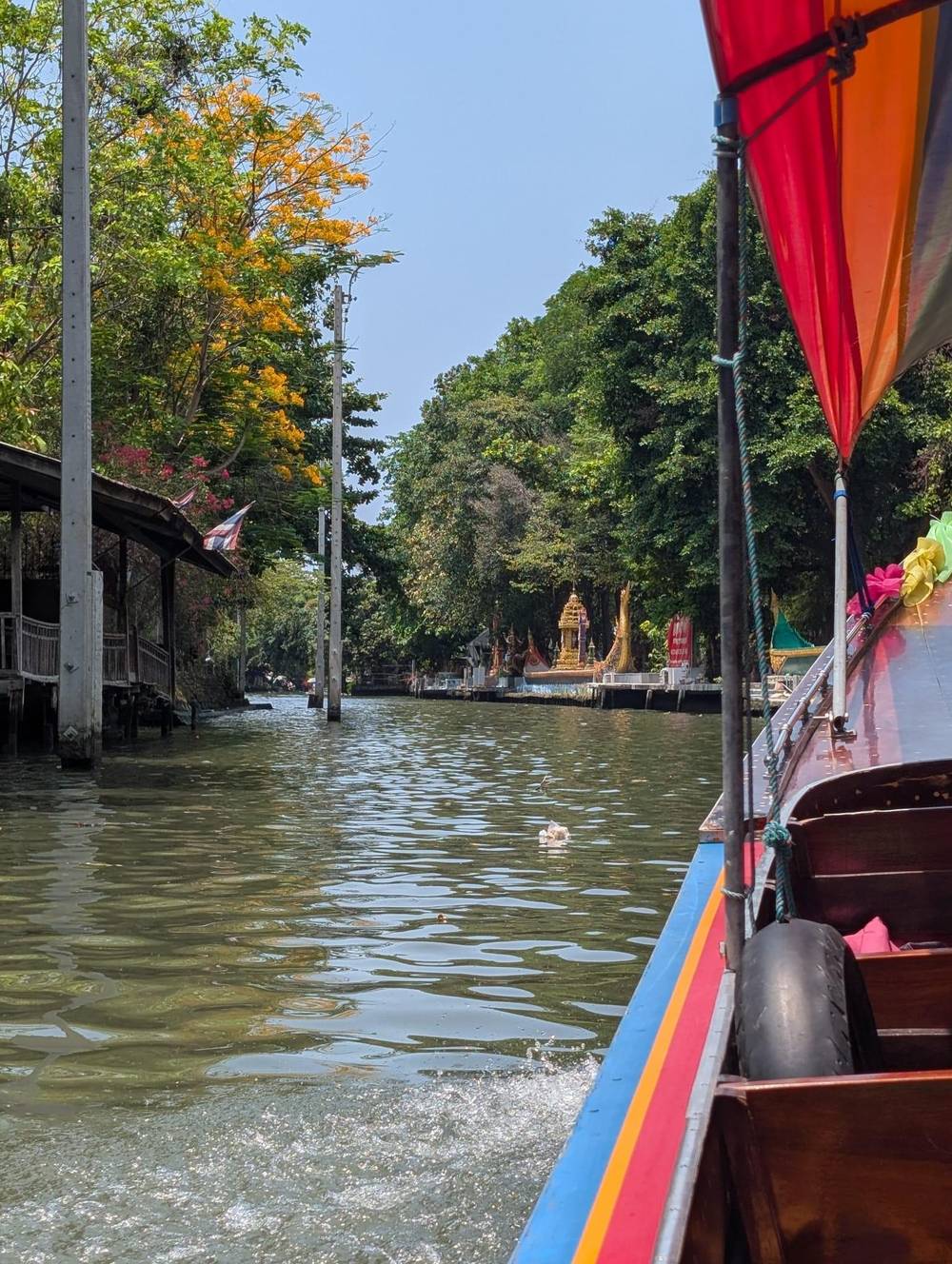
Bangkok grew up as a network of canals or khlongs, and the local residents made their homes either on boats or stilts above the waters
Before you go
The canals are not only scenery. TAT says Thai canals play a huge role in protecting Bangkok from seasonal flooding, while visitors usually give them just a few hours for the charm of canal-side life.3,27 That second point is worth holding onto: the boat you ride is the visible face of a drainage system, and the water level you see on a given day is not decoration. Ask the guide what the level means for the day.
The timing of the water matters too. TAT says October and November bring the river's high tides from the Gulf of Thailand,28 and in 2005 the Lat Pho Canal was deepened and widened with gates so that it could drain water quickly into the Gulf.14 That is the season to expect locks and held boats, and it is also the season to look for riverside festivals, since the Vijit Chao Phraya light route runs nightly from 13 November to 13 December in 2026.29
For the people who live here the canals are also a daily route. TAT calls Bang Krachao, the green bend across from the city, the lungs of Bangkok, and says boats wait at the river pier behind Wat Klong Toey Nok to carry people across.30,31 Thonburi works in the same way on a smaller scale, and the boats you meet on the water are not all there for visitors. Ask your guide about the working traffic and the locks.
There are several ways to see the klongs, and they suit different readers. The site's longtail tour is a 2 hour guided run with an English-speaking guide, from $34, with cancellation free until a day before. The bike and boat option runs 3.5 hours with temples and a meal, from $47. A boat tour to the Big Buddha view and the Artist House with a group of up to 8 starts from $41.
If you want a private boat and your own route, a private longtail with a flexible plan is listed from $117 for the whole boat, so share the cost over the people in your party. A private boat lets you linger, which the Artist House stop rewards. For a different feel, the free BMA electric boat on Phadung Krung Kasem Canal is a working canal with nobody to explain it.11 Each gives a different slice of the same network.
Whatever you choose, read the good-to-know lines of the listing. The site's record says the tour runs rain or shine, that no refund is given when weather cancels it and that boarding has no stairs at the piers, which it ties to a warning for travelers with mobility issues. Wear shoes you can walk in on wet boards, carry water and bring cash for the cafe at the Artist House. Then go early and let the water do the talking.
FAQ
The site's record names Khlong Bang Luang, and a bike and boat listing names Bangkok Yai.
TAT's 2024 news pointed the public to a Thonburi dockyard, and the barges have their own national museum.16
The site's record says the piers have no stairs for boarding and leaving the longtail boat.
Sources
Planning a Bangkok canal cruise? Ask a real person here.